


How to get there?

Chihuahua City
Chihuahua is located in the northwestern region of Mexico, bordering New Mexico and Texas (USA) to the north, Coahuila to the east, Durango to the south, Sinaloa to the southwest, and Sonora to the west.
There are multiple transportation options to reach Chihuahua. The state capital, Chihuahua City, and the largest city, Ciudad Juárez, both have international airports with flights from across Mexico and abroad. However, the most convenient and closest airport for the event is in Chihuahua City.
For those who prefer to travel by road, Chihuahua boasts an extensive network of highways connecting it to major cities in both Mexico and the United States. However, it is recommended to travel by plane, bus or by car.
The closest major airport is Chihuahua International Airport (CUU), located 13 kilometers from the city. From there, you can reach downtown in about 25 minutes.
This airport has flights from major cities in Mexico like Mexico City, Guadalajara and Monterrey as well as some from the USA.
The main airlines operating here are Aeromexico, American Airlines, Calafia Airlines, TAR, United Airlines, VivaAerobus, and Volaris.
International Connections: If you're coming from outside of Mexico, you can connect via Mexico City International Airport.
The well-developed road networks in Chihuahua and the impressive landscapes make getting here by car a true pleasure.
The best routes to Chihuahua from the main cities of Mexico:
- From Monterrey: Via Saltillo - Matamoros, the distance is 805 kilometers and takes approximately 9.5 hours.
- From Mexico City: Via Torreon - Jimenez 49D and 45D, the distance is 1,444 kilometers and takes around 18 hours.
- From Guadalajara: Via Carr. Torreon - Jiménez/México 49D, the distance is 1,182 kilometers and takes around 15 hours.


Los Mochis, Sinaloa
Los Mochis is located in the northwestern state of Sinaloa, Mexico, bordering the Pacific Ocean to the west, Durango to the east, and the Sierra Madre Occidental mountains to the south.
There are several transportation options to reach Los Mochis. The city is served by Valle del Fuerte International Airport (LMM), which offers flights to and from major Mexican cities, making it the most convenient airport for those traveling to the region. However, you will only need to fly to Los Mochis if you have already purchased your train tickets (Chepe Express) in advance.
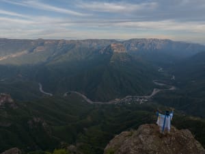
The Chepe Express operates only a few days a week and usually departs early in the morning. Therefore, you will need to spend the night before in Los Mochis. Be sure to purchase your tickets in advance, as they are not available for purchase on-site. This is a highly recommended option for those wanting to experience the breathtaking Sierra Tarahumara by train—one of Mexico's most remarkable natural wonders.
For more information and to purchase tickets, visit the ChepeExpress website.
To get to Los Mochis by plane, you’ll fly into Valle del Fuerte International Airport (LMM). Major Mexican airlines like Aeroméxico and Volaris offer direct flights from cities such as Mexico City, Guadalajara, Monterrey and Tijuana.
International travelers can connect through Mexico City (MEX), with flights from airports like Los Angeles (LAX), Houston (IAH), and Dallas/Fort Worth (DFW), before taking a direct flight to Los Mochis.
To reach Los Mochis by road, the city is well-connected via an extensive network of highways. Here are some of the most common routes:
- From Monterrey: Via Saltillo - Matamoros, the distance is 805 kilometers and takes approximately 9.5 hours.
- From Guadalajara: Via Carr. Torreón - Jiménez/México 49D, the distance is 1,182 kilometers and takes around 15 hours.
- From Mazatlán: Via Carretera 15, the distance is 500 kilometers and takes about 6 hours.
- From Culiacán: Via Carretera 15, the distance is 400 kilometers and takes around 5 hours.
You can drive directly to Los Mochis from these cities or take a bus.


